Cottesloe
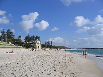
Cottesloe is a western suburb of Perth, Western Australia, within the Town of Cottesloe. Cottesloe was named for Thomas Fremantle, 1st Baron Cottesloe, a prominent Tory politician and the brother of Admiral Sir Charles Fremantle, for whom the city of Fremantle was named. The nearby suburb of Swanbourne was named for the Fremantle family seat, Swanbourne House, in Swanbourne, Buckinghamshire.
Soil zone · Spearwood Sands
Yellow-brown sands over Tamala limestone at varying depth. Free-draining with mildly alkaline pH from the underlying limestone.
- Drainage
- High
- Water retention
- Low
Groundwater · Gnangara Mound
Large unconfined superficial aquifer covering most of Perth north of the Swan River. Primary garden-bore source for the northern suburbs.
- Bore prevalence
- Very high
- Water table
- 1-5 m
Rainfall (2024)
Annual rainfall captured at this suburb's coordinates from Open-Meteo's ERA5 reanalysis archive.
- Annual total
- 674 mm
- Wet season (May-Sep)
- 557 mm
- Dry season (Nov-Mar)
- 53 mm
- Source
- open-meteo
Demographics & geography
- Population
- 7,750 (as of 2021-08-10)
- Area
- 3.8 km²
- Density
- 2,039 / km²
- Postcode
- 6011
- LGA
- Town of Cottesloe
- Coordinates
- -31.9930, 115.7570
- Drive distance
- ~16.5 km from Jandakot HQ
Page content this drives
With four independent data dimensions per suburb (soil, bore, rainfall, demographics), the static landing page can vary 5+ content sections meaningfully — not just by suburb name swaps. Real differentiation is what avoids Google's doorway-page penalty.
- Hero copy
- "Reticulation services in Cottesloe (Town of Cottesloe) — 16.5 km from our Jandakot workshop"
- Soil-aware advice
- "Cottesloe sits in the spearwood sands zone. Moderate cycles work well."
- Bore vs scheme
- "Bore prevalence here is very high (Gnangara Mound, water table 1-5 m)."
- Rainfall context
- "Annual rainfall ~674mm with 53mm in the dry season - irrigation must cover the gap."
- Schema.org payload
- LocalBusinessServiceareaServed: CottesloegeoCoordinates